Hi @stijnvh, welcome to the community! We really appreciate you sharing feedback directly from users ![]()
We started with the default geopoint because it's currently the most distinct from Enketo.
Our goal is to create a different user experience for geo questions with a map, as the user needs in these situations can vary. As you said, the user might not be in the current location, and we want to ensure the experience is intuitive. We intend to support the same appearances as Collect. I'll address each of your points below.
the accuracy/altitude can not be hidden separately, with hide-input also lat/lon is hidden. For the placement-map approach as we need it the altitude/accuracy is not important
Could you tell me a bit more about what you want the user to see and what you want to hide and why. Do your users ever need to enter in latitude and longitude coordinates manually?
on mobile, the map opens in a separate modal which needs a click on 'map', which was not intuitive for some users
I completely agree and have heard this is very difficult to use and causes confusion with other Enketo users. We want to avoid this and show the map inline with a clear action button to make a better experience across devices.
Changing the 'back' button (red circle) in a checkmark or 'confirm location' would improve the UX a lot.
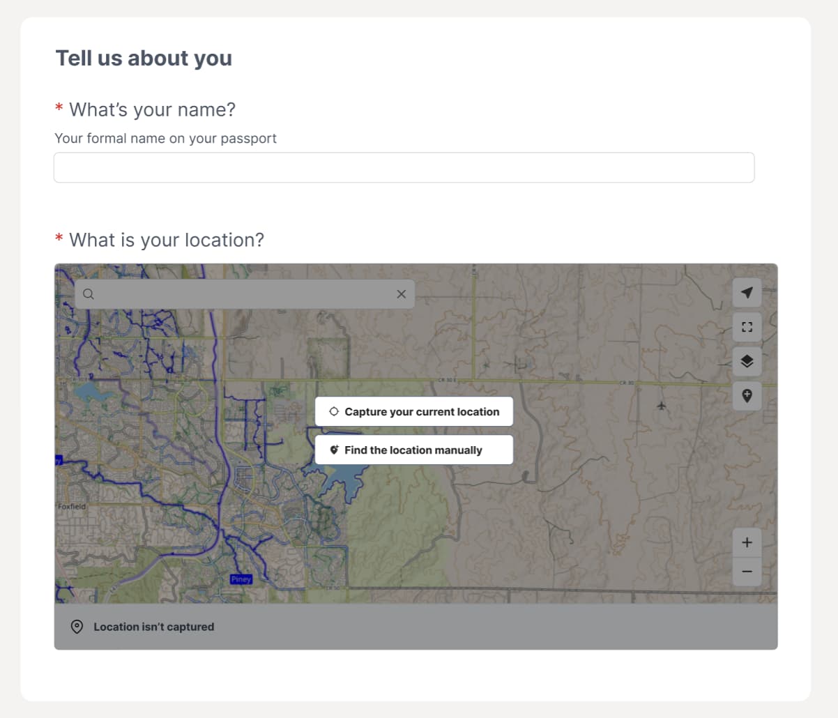
The UX here is very confusing, and we want to make the paths very clear, either capture the current location or enter manually. Here is a screenshot of some early thinking on this concept (this would be similar for mobile, and I'll share more once we have fleshed out the design a bit more)! You'll notice we have this overlay with the two buttons for the different paths, so it’s clear what will happen next.
In your case would people want to manually enter in an address or do you have something else in mind?
Once they have captured the right location, I'm curious to know what the user would want to see to help them verify and confirm this is correct. Do they want to see "Poor" or "Good" accuracy with the coordinates, the address, or something else?
You mentioned water samples above, could you tell us a bit more about your workflow? Understanding what you're trying to achieve is really helpful as a reference point when we are designing and building these features.
If you get a chance, please introduce yourself here.