I had the same issue still looking for solution for it. Here are some thoughts that came in my mind though am looking on how I can implement it
1.External GPS configured to collect information on it is own, to do some calculation on it is own and what it can share to ODK is only a print out of the final results based on desired accuracy being reached. Like you have configured your Dual frequency GPS to retrieve a location and send the report after accuracy being reached let say 5cm and once attained that accuracy, the print out of the coordinate to be sent to ODK for records to your GPS format of interest (This might need some programming skills to enable logging of the data from the Mobile App that can log those information then parse those logged data to send only required information as programmed) Python can be used to enable Logging if mobile App does not allows, also can be used to parse the data to extract the desired those required one also to link with ODK for print our to where you are looking for ODK to display those data. Any thoughts!
Hi @BORNLOVE_NTIKHA
My thoughts on this suggestion are that it sounds more like an 'intermediary' app that you are needing, to log GNSS data streams and calculate data on demand when requested by ODK Collect. Way beyond my competence! However, something highlighted by @seadowg raises a caution here - you'd need to be able to read data from an unknown range of GNSS devices (so possibly varying standards / language formats), which could limit the practicality of creating a solution that can be used widely.
I suggested in an earlier post a simple way of doing something that starts you on the road to averaged positions - use a geotrace to record a number of points, then process the results to calculate the desired answer. It's probably way more complicated, but if you record the geotrace for a set period (e.g. 2 minutes, recording a point every 10 seconds), you could then adapt the process suggested by @Xiphware in this post: ODK geoshape/geotrace/geopoint to KML to extract the coordinates and calculate an average (and presumably a standard deviation to contribute to your accuracy) which you could then use within your form - take note of the cautions he includes at the bottom of the post! Or process the geotrace field once you've downloaded the instance.
I'm still learning the ropes with my high accuracy GNSS receiver, but one salutary lesson is that the log files are huge. I'm not sure how practical it is store them or even access them from ODK. And as with all data, I am mindful of not getting hung up on accuracy at the expense of meaning - it does matter that I have accuracy of 1m or less for some work (rather than 3-6m which is sufficient in many of my projects) but 5cm accuracy would give a false sense of quality (and probably isn't repeatable anyway, without a tripod, for example, which I never carry in the mountains!). It's a similar argument to people worrying about how many 'significant figures' to present when the underlying data is coarse.
Apologies if that sounds disrespectful of your idea or needs, I'm just a boring pragmatist!
Implementing and maintaining extra cases brings extra cost, so right now we'll just focus on the problem we understand and allow configuring a form so that it behaves as before in Collect (as in my proposed changes). We'll go with a more specific parameter name, as you suggested.
I'll post an update when we have a beta release of Collect ready to test!
Hi @LN and the team.
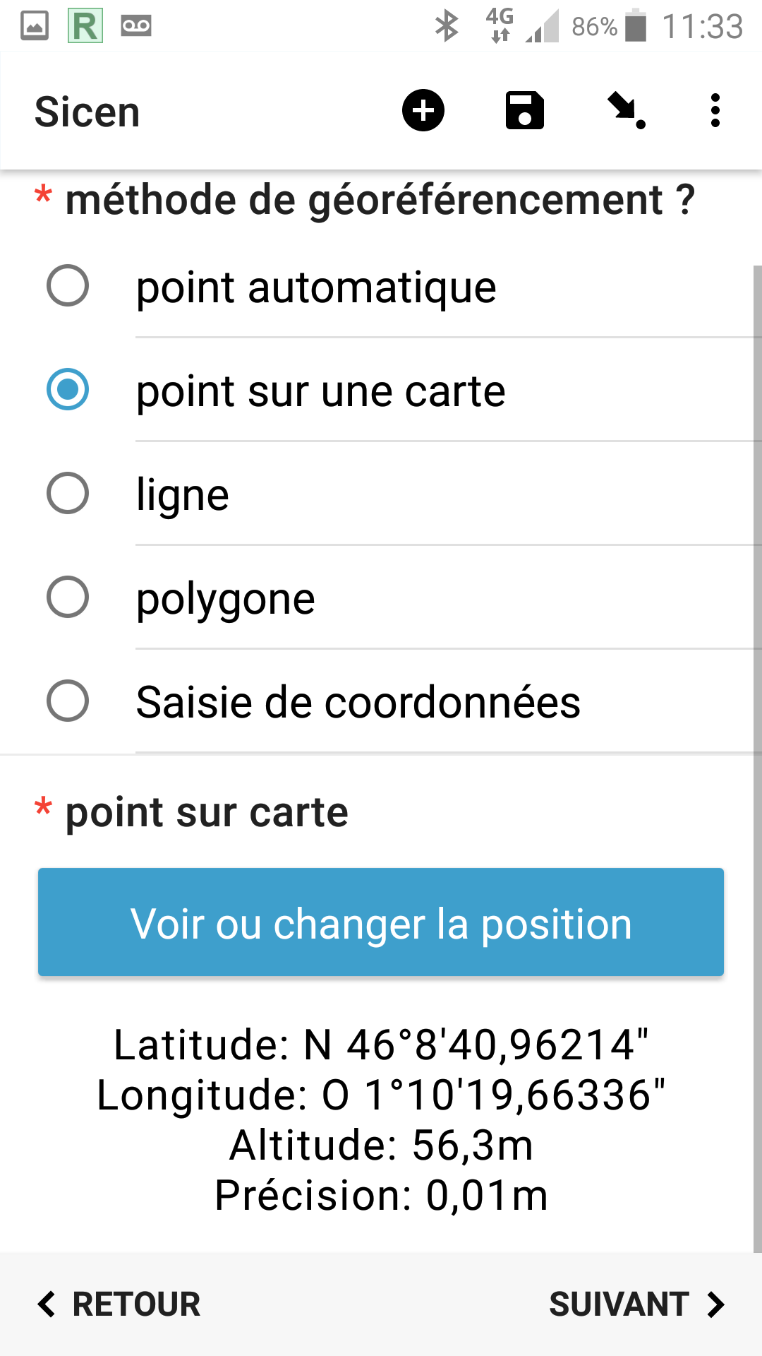
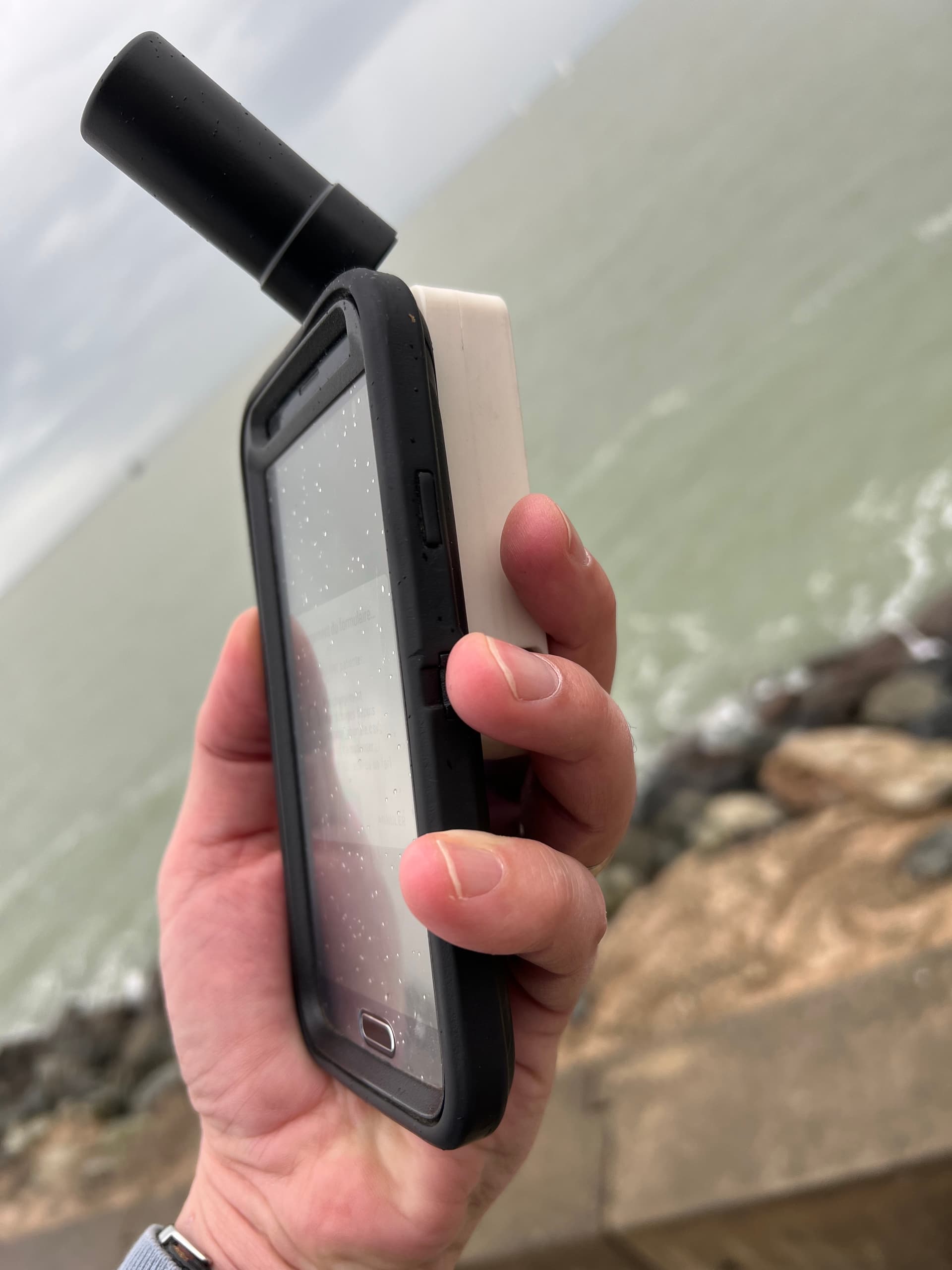
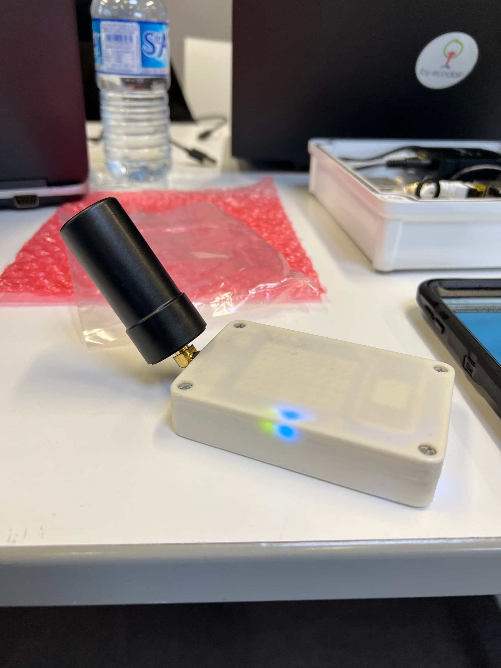
Just in time to test with success -) the 2021.3 beta and the "mock-location accuracy usage" new parameter. @Remy_CLEMENT and I followed a course this week by Julien Ancelin about the open GNSS RTK Centipede network he initiate and this morning we can test the v2021.3 beta with success, using a DIY RTK Rover behind a Lefebure NTRIP Client
Here are the screenshots of the taken geopoint and pictures of the the rover.
One (out of topic) learn is that with such a DIY material, without using the RTK correction, we got better than 50cm accuracy And 1 cm with the RTK activated
More information about this (great) open and reproducible project on the https://docs.centipede.fr
Well done everyone! I have tested it (I know, you've already done that) and can now use forms where external GNSS measurement accuracy can be included. Perfectly timed as I have some fieldwork to do next week where sub-metre accuracy is important (GCPs for a drone survey!)
Thanks especially to Callum @seadowg for implementing the solution.