A map to show saved forms with geodata and entity geodata for the same form in Collect

What high-level problem are you trying to solve?

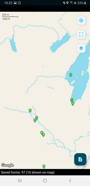
When collecting data using the ‘saved-forms’ map accessible via the map button is really useful to see progress

But can’t functionally be used to navigate to another pre-defined location. To do that, if the locations are pre-defined as entities, I need to put a question at the beginning of the form: select_one_from_file with map appearance. But this can cause confusion as to where to find data between field recording points. Previously I have used offline layers as base maps for this purpose, but entities provide much greater power / flexibility in fieldwork planning…

I would like to combine these functions so that in-the-field ‘navigation’ can be simplified (whether the entities should also be selectable is a moot point, but would be nice :slight_smile:).

Any ideas on how ODK could help you solve it?

This fits loosely with the Entity First workflow that is being developed (on hold at the time of posting), but is (in my head) a more simplified approach that works with existing workflows and tools rather than introducing new ones - if Collect can load geodata from forms and entities, why not combine? Can Collect draw in geodata from both the saved forms db and the entity list related to the form? Could this ‘view’ be an option for the form definition, or the default ‘saved-forms’ map view if entities are present for the selected form?

We already have scope to control the appearance of entities, so could avoid (too much) confusion with point data (e.g. marker colour and icon), but there might be some issues if entity locations and saved form locations exactly coincide?

This doesn’t give a full picture of collected data at a multi-enumerator scale, but does help the people in the field managing their physical / geographical work flow using a single map…

Upload any helpful links, sketches, and videos.

I have tried to imagine what it might look like:

A (real) saved-form-map … … … … An entity map for the same form (yellow are updated entities)

A combined map (not very effective visualisation!)

3 Likes

Would love this & think its a very useful step towards a ‘map first' data collection experience in ODK :smiley:

2 Likes

Thanks for sharing this example!

What's the relationship between the points representing the completed submissions and the Entities? It looks to my eye like they're mostly unrelated. I would generally expect that you could change the status/color of already-visited geometry. It sounds like you've done that with the Entities that are shown as yellow AND have markers for submissions that represent a different kind of completed work.

The submissions include a photo and so the point relates to that location (and the survey was looking at the entities but also recording things nearby that do not directly relate to the entity - so some of them coincide and some of them don’t). The black marker is actually a new entity, created on another device, but the existing entities are lines in this case. The form updates the colour of the entity when visited for this survey (and again when verified). So in this scenario the verifier may not have the submissions on their device, but would be navigating between the yellow entities. Wouldn’t it be nice if the entities could include the images that were taken :face_with_peeking_eye:

I am looking at this idea mainly in terms of having a single point of entry (consistent workflow!) for navigating in the field without needing a whole new strategy. I have ended up discarding forms (or saving as draft) that I have been using to navigate to an entity because I need a different form for something I encounter on the way… I have also been know to get myself momentarily confused (ahem!) as to which map I am viewing, wondering why I can’t start a new form, or what has happened to the entities! Plenty of “Doh!” moments in my fieldwork.

Previously I would use offline layers to mark the predefined points or existing data - I have taken a step forwards in being able to access that data but perhaps a side step in being able to pull it all together in the field. I have used BOTH a base map and entities but it starts to get cluttered…

1 Like