Hi everyone!
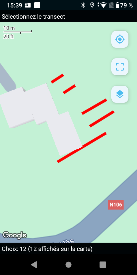
In a form using a geojson for a select_one_from_file with a map appearance, 2 lines materializing walls to check are placed behind the bulding drawing in Google Streets base map and therefore, not visible.
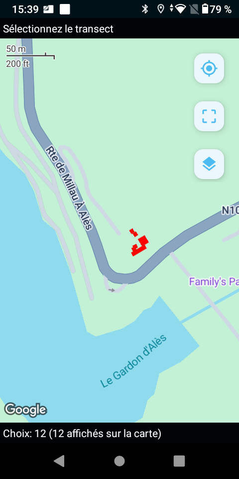
They appear again when I zoom out, but it's a too small scale to work.
When I've changed the base map, switching to Google Satellite and the lines were correctly displayed .
With OSM base map, I can see the lines but because the building drawing doesn't appear exactly in the same location than with Google.
- Here are the screenshots:
- With Google Streets base map at a large scale:
* - With Google Streets base map at a small scale:
- With Google Satellite:
- With Google Streets base map at a large scale:
- a simplified version of the form:
podarcis_liolepis_pr_pb_affichage.xlsx (638.2 KB) - and the external file (I added a point between geo and json to upload the file because geojson are not authorized extensions):
podlio_transects_murets.geo.json (5.0 KB)

Have you ever had a similar problem?
Nathalie