I am collecting geometries in 'geoshape' and 'geopoint' field types using an external GPS sensor. I need the accuracy of individual points so I've added to both fields the "allow-mock-accuracy=true" value in the parameters column. In the case of the geopoint, it works fine. the accuracy is displayed during collection and stored properly. But, in the case of the geoshape, the accuracy display during collection is always 0 and certainly no accuracy is saved once the geoshape is completed.
Hi @jmmgnl
When you get a chance, please introduce yourself here. I'd also encourage you to add a real picture as your avatar because it helps build community!
Which mode of recording points are you using?
- Placement by tapping - in this mode the accuracy should be because you select the exact place manually.
- Manual location recording - in this mode the accuracy should be recorded but it doesn't seem to work like that.
- Automatic location recording - in this mode the accuracy should be recorded and it seems to work fine.
is it Manual location recording?
Hi @Grzesiek2010,
Thanks for the reply. I will update my profile a.s.a.p.
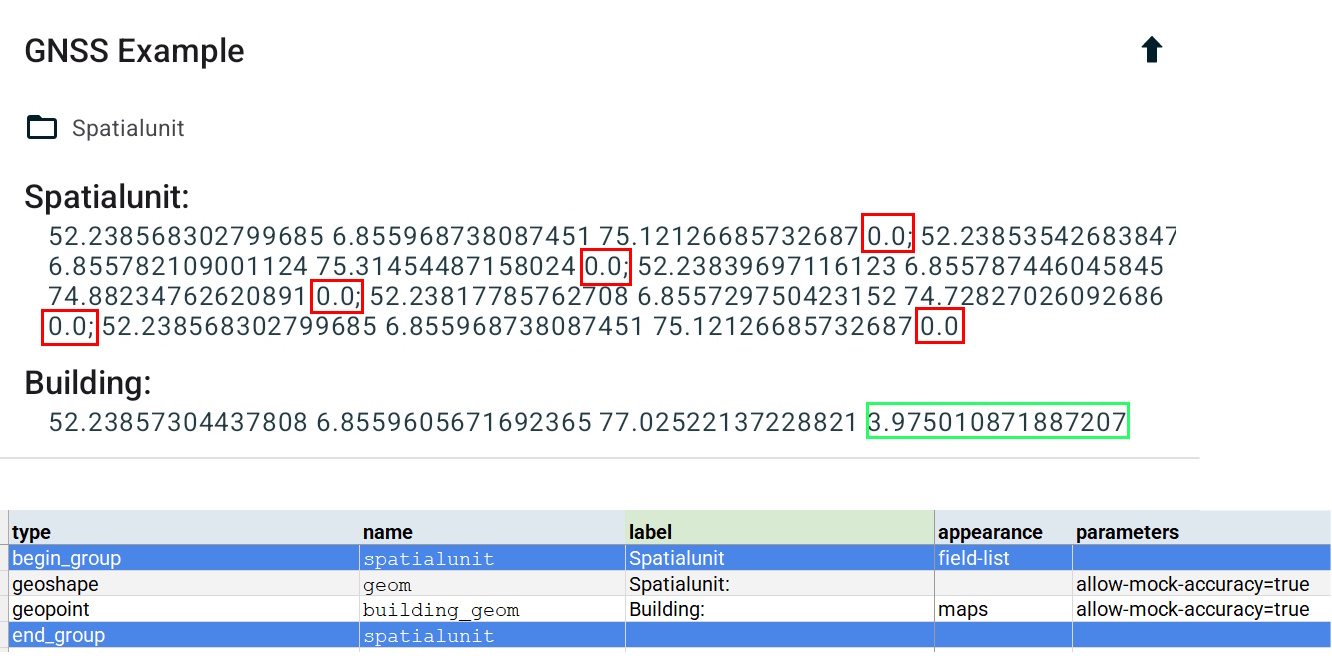
We are using Manual location recording. The GPS is mounted on a pole, and we collect vertices only when it is placed at the right locations along the boundary of the geoshape.
Thanks! That appears to be a bug. I've filed an issue here: https://github.com/getodk/collect/issues/6657. We'll investigate further and work on a fix.
OK. Thanks!!! I will follow developments closely...
@jmmgnl We’ve released version 2025.1.4, which includes a fix for this issue. Thank you once again for bringing it to our attention!
1 Like