Hi all,
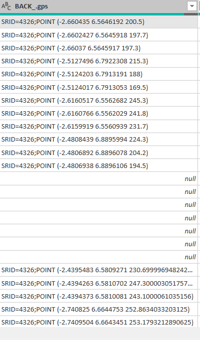
I am trying to create a map visual for my data after connecting directly to ODK central via OData Feed. I realized the usual longitude and latitude columns are no more available, rather they are put together in one column in this form SRID=4326;POINT (-2.660435 6.5646192 200.5). Now how do I get the data back to longitude and latitude to create my map visual? When I download the data as csv file, I see the longitude and the latitude. Why is the data this way when I connect through OData Feed. Thank you.
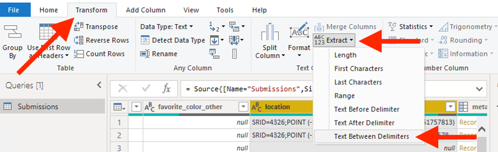
In the Transform tab, select Extract, then Text Between Delimiters. ( is the Start delimiter and ) is the end Delimiter.
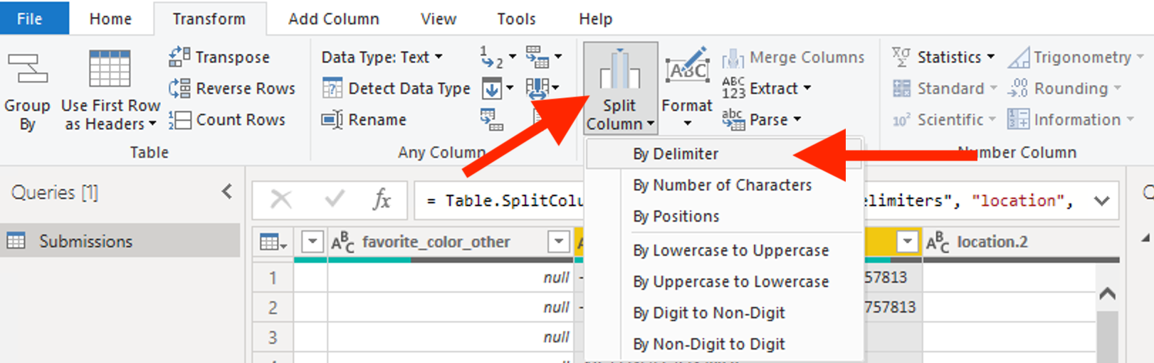
Then select Split Column, then By Delimiter. Use Space as the delimiter.
The columns after you split follow the geopoint data type. The first column is latitude, the second is longitude, the third is accuracy, and the forth is altitude.
Thank you, Yaw. It's really helpful. I initially thought there was something technically wrong with my form design which is not compatible with ODK Central platform. I am relieved now. Many thanks.