Geolocation capture is useful but the wait for a GPS fix can feel slow.
Adding an automatically captured geopoint (start-geopoint) to an ODK form "warms up" the GPS chip speeds up location capture.
Initial testing shows reductions from originally ca 15 seconds to sub 3 seconds.
Some use cases require the enumerator to capture a precise location (e.g. a turtle nest), which is not always the location in which the form is opened initially. Here, the initial location itself is not of interest, but the speed from a pre-warmed GPS chip is most appreciated.
XLSForm
Add field of type start-geolocation to survey
Adding a start-geopoint to an XLSForm is as simple as adding one line to the sheet survey (see docs):
type: start-geopoint
name: start_location
label: Any label
You can choose your own name for the field (here: start_location), and adding a label (although it will never be shown) silences a warning when importing the form into ODK Central.
An example XLSForm start_geolocation.xslx is attached. The example form is based on this form demonstrating how to calculate the name of the saved form from form data.
XForms
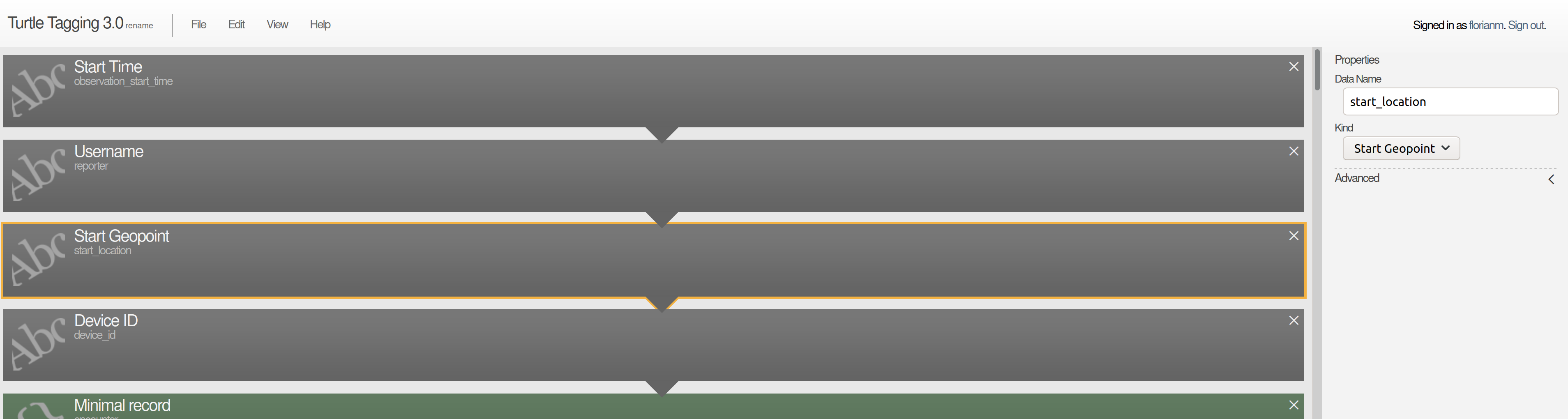
Unfortunately, ODK Build does not yet support this field type, and form maintainers who prefer to build their forms in ODK Build must hand-edit the exported XForms XML before uploading it into ODK Central as follows. Note we'll use the arbitrarily chosen field name start_location from our example.
Add additional namespaces
Replace the opening <h:html> tag with:
<h:html
  xmlns="http://www.w3.org/2002/xforms"
  xmlns:h="http://www.w3.org/1999/xhtml"
  xmlns:xsd="http://www.w3.org/2001/XMLSchema"
  xmlns:jr="http://openrosa.org/javarosa"
  xmlns:ev="http://www.w3.org/2001/xml-events"
  xmlns:odk="http://www.opendatakit.org/xforms">
This adds the namespaces ev and odk. The line breaks are only for readability.
Add the field to data model
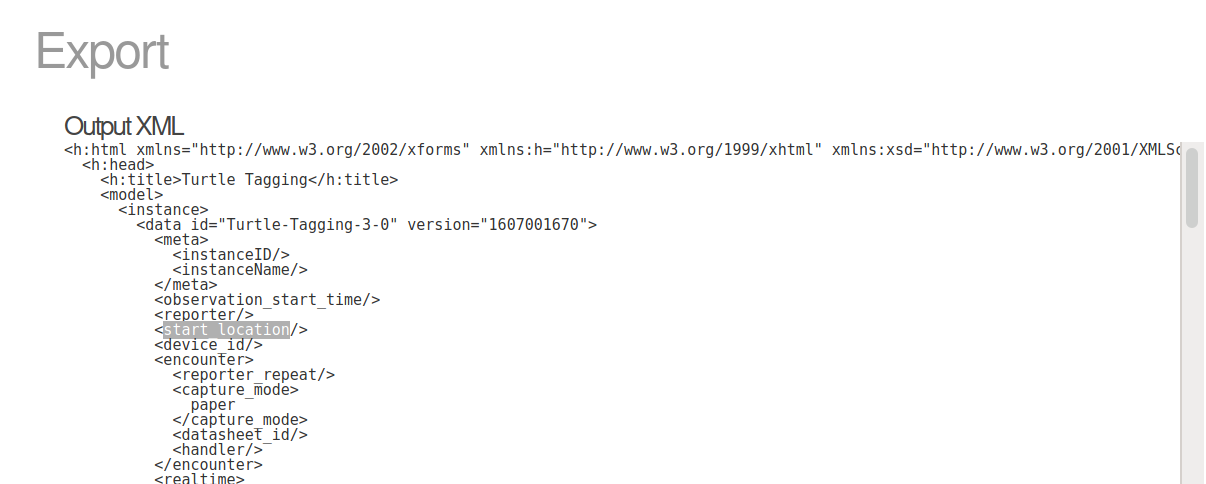
Insert the field name <start_location/> as child of the <data id="" version=""> tag:
<start_location/>
Substitute the example name start_location with your chosen name.
Bind field type and trigger action on instance first load
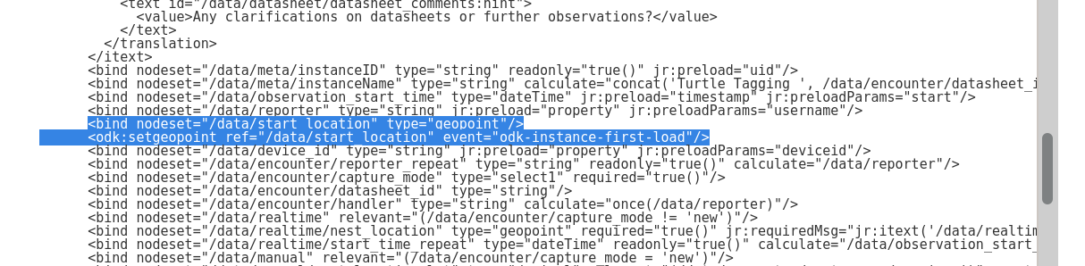
Insert as children of the <model> node and siblings of the <bind> nodes:
<bind nodeset="/data/start_location" type="geopoint" />
<odk:setgeopoint event="odk-instance-first-load" ref="/data/start_location" />
As per the Xforms spec on actions, we're using the action <odk:setgeopoint> to set the start_location on event form start.
XForms action can also set the location on other events, such as adding a repeat.
Considerations
Warning message
The background location capture of the start-geopoint field generates a warning message, which pops up as a "toast" from the bottom of the screen each time. This needs to be communicated to the enumerators to prevent anxiety.
Give start-geopoint a 20 second head start
The start-geopoint runs for exactly 20 seconds and returns the most accurate location captured in this time span. The form should be designed such that the enumerator will only capture the first "proper" geopoint/trace/shape after these 20 seconds. An easy way of achieving this is to move the first geo field a few questions down, so that the enumerator spends a few seconds answering other questions while the start-geopoint runs in the background.
Conversion
An XLSForm can be converted to the corresponding XForm with the command line tool pyxform's function xls2xform:
$> xls2xform start_geolocation.xlsx
$> Conversion complete!
Source: pyxform on GitHub
Attachments:
XLSForm and XForms versions with and without start-geolocation:
start_geolocation.zip (14.9 KB)
I'd be interested to hear back about time savings (which devices did you use, how much faster is the pre-warmed vs the cold GPS), and which use cases you're using this in.