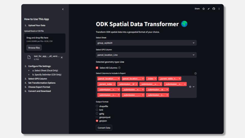
I’ve noticed that many ODK users struggle with transforming collected data into usable geospatial formats, especially when trying to upload it to GIS tools or Google Earth Engine. To make this process easier, I’ve developed a Streamlit app that automatically detects geospatial data (points, lines, polygons) and converts it to formats like Shapefile, GeoPackage, KML, GeoJSON, or GeoParquet—all without needing any coding skills.
![]() Try the app here
Try the app here
![]() Read more about it in this blog post
Read more about it in this blog post
![]() GitHub repository
GitHub repository
I’d love to hear your feedback and ideas for improvements! Let me know if you have any questions or suggestions.