I have a database identified by an identification number and I want to preload the polygons so that they are displayed in the application, with the selected-at function I use it, but since the coordinates have ; I get an error. Is there any other way to preload these coordinates? @Sadiq_Khoja
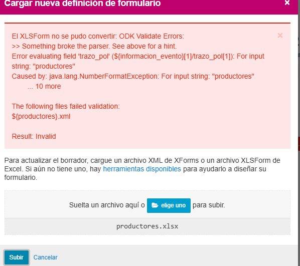
when loading the template I get this error and when loading .csv the polygons are not displayed in the application, I don't know where the error would be, If you could help me I appreciate it.
productores.csv (410 Bytes)
productores.xlsx (437.7 KB)
Hi @Daniel_Zota,
I was able reproduce the error that's there in your screenshot. It looks like there is some issue with using pulldata for setting calculated values of geo types.
I have updated your Form definition and csv file for the following corrections and workaround:
- Corrected the position of quotation marks in your csv file.
- Changed the
calculate of 'poligono' to use List lookups
formula instead of pulldata, for that I had to include a hidden select_one_from_file question with relevance=false and custom value/label parameters.
- Changed the type of 'trazo_pol' to
geoshape since you have polygon in your dataset - this is optional, you can revert this back to geotrace if not all of the datapoints in your dataset are polygons
productores.xlsx (438.0 KB)
productores.csv (404 Bytes)
1 Like
Hi, @Sadiq_Khoja Thank you for the answer, I have one last question if in the CED field, the person has more than two (2) polygons, how could these two fields of IDs be visualized, on different maps. I share with you the file column c: CERTIFICATE (the duplicate ID cards are highlighted in red) I thank you very much for your collaboration and explanation of the error.
24.10_socodevi_ODK.xlsx (151.3 KB)
You can use repeat with its repeat_count equal to the number of matching rows in your dataset. For example: count(instance('soccodevi')/root/item[{CEDULA=${cedula}]).
In the repeat you can add geoshape to show each matching polygon. Calculate would look something like instance('soccodevi')/root/item[{CEDULA=${cedula}][position(..)]/Coordenadas
1 Like
Hello, @Sadiq_Khoja When I do it in the template it is not working as I expected, do you have an example with the template that I had shared with you previously, please
I have attached an example. Sorry for the delayed response, I am traveling these days.
productores.xlsx (211.2 KB)
productores.csv (1.3 KB)
1 Like
Thanks for your help, very kind for replying
